Hiking Mount Shasta's Glaciers: A Complete Guide to Climbing the Ice in 2025
- September 9, 2026
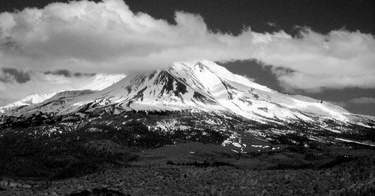
Photo by Randy Siebold via Pexels
Mount Shasta rises from the Siskiyou Crest like a capstone on the ancient Klamath Mountains, its 14,179-foot summit catching cloud shadows that race across the ice fields below. Of all the glaciated peaks in the contiguous United States, Mount Shasta carries the most: seven named glaciers cascading down its flanks like frozen waterfalls arrested mid-pour. These ice bodies have drawn climbers, scientists, and seekers to their margins for generations, offering passage to the summit via routes that demand technical skill and deliver rewards that linger in the body long after the ache of descent fades. The Hotlum, Wintun, Bolam, Whitney, Konwakiton, Mud Creek, and Watkins Glaciers together cover roughly 3.5 square miles of the mountain's upper reaches, storing water for the Shasta River, Sacramento River, and Klamath River watersheds while also serving as a measure of climate stress unfolding in real time.
The Seven Glaciers of Mount Shasta
The largest of Mount Shasta's glaciers, the Hotlum, sprawls across the mountain's north-northeast face, covering about 1.3 square miles of ice that descends to around 9,500 feet. This ice mass carves slowly into the basalt below, feeding streams that join the Klamath system during summer melt. The Wintun Glacier, the mountain's second largest at about 0.7 square miles, occupies the north side of the summit cone and shares a drainage divide with the Hotlum. Their meltwater converges in the headwaters of the Shasta River watershed.
The Bolam Glacier cups the northwest quadrant of the mountain, its roughly 0.3 square miles of ice cradled in a cirque that shields it from the worst of afternoon sun. The Whitney Glacier flows down the southeast face for about 0.4 square miles, one of the longest continuous ice routes on the mountain. It historically served as a primary ascent corridor before the route's lower sections turned increasingly ice-free and rocky in recent decades.
On the southern slopes, the Konwakiton and Mud Creek Glaciers each cover about 0.2 square miles. Their positions expose them to more solar gain than their northern counterparts. These southern ice fields have retreated noticeably in recent decades, their termini now sitting hundreds of feet higher on the mountain than mid-twentieth-century photographs show. The Watkins Glacier, the smallest named glacier at roughly 0.1 square miles, clings to the northeast face in a narrow couloir that offers technical climbing for those seeking solitude away from the busier Hotlum-Wintun corridor.
Best Routes for Glacier Hiking
The Hotlum-Wintun Ridge Route is the most popular and practical glacier route on Mount Shasta, threading between the two largest ice fields along a divide that offers consistent snow coverage from May through July. The technical difficulty is moderate, suitable for groups with glacier travel experience. The route starts from the Bunny Flat trailhead at 6,900 feet, climbing through forest before breaking above treeline into the Sierra Nevada-like alpine zone that defines the mountain's upper personality.
From the ridge divide at around 12,000 feet, climbers can move onto either the Hotlum or Wintun Glaciers for summit approaches. The Hotlum offers the more continuous ice route to the summit plateau. The route requires rope work for crevasse crossings above 11,500 feet, and groups should expect sustained angles of thirty to forty degrees on the upper glacier. The round-trip from Bunny Flat to the summit and back covers about 12 miles with 7,300 feet of elevation gain, a serious day climb or comfortable two-day ascent when combined with a high camp at 10,000 feet.
Avalanche Gulch climbs through the south-southwest flank toward the summit crater and has historically been the path of least technical resistance to the top. However, increased rockfall from the deglaciated lower sections has made this route more hazardous in recent years, and the route's reliance on snow bridges over crevasse fields has become less reliable as the glacier thins. Experienced groups often use Avalanche Gulch for descent after climbing the Hotlum Glacier on ascent, threading between the Mud Creek and Konwakiton termini through terrain that demands constant vigilance for falling rock released by solar warming.
Required Gear for Glacier Travel
Mount Shasta's glaciers demand equipment appropriate to moderate alpine ice climbing, not casual snow hiking. Crampons, specifically step-in or strap-on models with twelve to fourteen points, provide the bite necessary for sustained glacier travel on slopes that can reach forty degrees or steeper. Aluminum hiking crampons marketed for winter trail hiking lack the durability and precision needed for sustained ice work and will fold or ball up with snow in the conditions that prevail on Shasta's upper routes.
An ice axe remains essential for self-arrest and for step-cutting on the steeper sections of the upper glaciers. Technical ice axes with curved shafts and modular picks serve groups planning mixed climbing, while mountaineering axes with classic picks work fine for standard glacier routes. The mountaineering axe should be sized so that, when held at the side, its spike reaches no more than two inches below the climber's ankle.
Rope work is a non-negotiable part of glacier travel on Mount Shasta. Groups of two to four should travel roped together on the glaciers, using appropriate glacier rope: a thin, lightweight line between 6mm and 8mm in diameter for half ropes, or 8mm to 9mm for single rope work, packaged for efficient deployment. Running belays become necessary where crevasse bridges thin to less than six inches of solid snow over open voids that can swallow a human body whole. Traditional climbing ropes prove too heavy for efficient glacier travel but work well for the technical crux sections if groups venture into steeper ice.
Best Season for Glacier Hiking
May through July offers the optimal window for glacier hiking on Mount Shasta, when snow coverage remains continuous from the trailhead to the summit and overnight freezes restore strength to snow bridges weakened by daytime sun. June typically provides the deepest snowpack and most complete glacier coverage, though afternoon thunderstorms become increasingly common as the mountain settles into its summer pattern. July sees the onset of significant melt, with glacier surfaces developing extensive moats and running water along their margins that demand careful navigation.
August and September present increasingly difficult conditions as summer sun erodes snow coverage on the lower routes and exposes the crevassed glacier ice beneath. The Hotlum and Wintun Glaciers retain viable snow coverage longer than the southern ice fields, and groups venturing late in the season should expect technical ice climbing rather than snow travel. Early season starts: departing the trailhead by 3 a.m. for a sunrise arrival at the glaciers avoid the worst of afternoon instability and deliver cooler snow for efficient travel.
The Glaciers' Role in the Ecosystem and Water Supply
The seven glaciers of Mount Shasta function as natural reservoirs, storing precipitation that falls as snow during winter months and releasing it as meltwater through the dry California summer when streams dependent on rain alone have long since dropped to trickle or dust. The Hotlum and Wintun Glaciers alone contribute an estimated 4,000 to 6,000 acre-feet of water annually to the Shasta River watershed, a flow that sustains cold water habitat for anadromous fish including the struggling winter steelhead and Chinook salmon populations of the Klamath system.
The retreat of these glaciers has already altered the timing and volume of summer flows in the mountain's tributary streams. Hydrologists monitoring gauges on Clear Creek and Mud Creek have documented earlier onset of peak spring runoff and diminished late-summer baseflows over the past three decades, changes attributed in part to shrinking glacier mass reducing the sustained melt contribution to streamflow. As the glaciers continue to lose volume under warming temperatures, the ecosystem services they provide will diminish proportionally until the remaining ice fields reach a new equilibrium with the changed climate or disappear entirely.
For the human communities downstream, these glaciers represent something harder to quantify than acre-feet of water: the assurance of continuity, the knowledge that snow and ice banked in the high country will return as cold flow through the hottest months. That assurance is eroding as visibly as the ice itself.
Climate Change and Glacier Retreat
The glaciers of Mount Shasta have lost roughly 30 percent of their combined volume since systematic measurements began in the early twentieth century, a loss that has accelerated markedly since 1980. The Konwakiton and Mud Creek Glaciers have retreated more than 1,000 meters from their Little Ice Age maximum positions documented in nineteenth-century survey records, their current termini sitting several hundred feet higher on the mountain than photographs from the 1970s depict.
Geologists studying the mountain's glacial history have determined that Mount Shasta's ice fields expanded to their maximum extent during the Little Ice Age, a period of global cooling that lasted roughly from 1300 to 1850. Since then, the glaciers have been in general retreat, interrupted by brief periods of advance during particularly cool decades. The current rate of loss, however, exceeds anything documented in the historical record. The Hotlum Glacier alone has lost an estimated 10 to 15 meters of thickness across its upper surface since 2000.
This retreat carries implications beyond hydrology. The exposed bedrock beneath the vanishing ice has begun to host pioneer plant communities adapted to periglacial conditions, and the structure of the mountain's upper ecosystems is shifting in response to the changing duration of snow cover. Some species that depend on the cold, stable microclimate of glacier margins face local extinction as their habitat contracts.
Guided Climbing Options
Groups lacking glacier travel experience or seeking instruction in crevasse rescue, rope management, and route finding can engage licensed guides operating from the Mount Shasta area. Several guide services offer two-day and multi-day programs that combine instruction in basic glacier techniques with guided ascents of the Hotlum-Wintun route or more technical climbs onto the Whitney Glacier's steeper flanks. Guided trips typically include group technical equipment: rope, ice axes, crampons, harnesses, while clients provide personal clothing and shelter systems appropriate to high-altitude alpine conditions.
Guided programs prove particularly valuable for first-time glacier travelers or for experienced mountaineers transitioning to ice climbing after a career in rock or snow travel. The crevasse rescue skills taught in a controlled instructional setting on Mount Shasta transfer directly to glaciated peaks worldwide, and the mountain's accessibility: roughly three hours from Interstate 5, makes it an ideal venue for building glacier competence before attempting more remote objectives.
Safety Considerations
The hazards of Mount Shasta's glaciers require respect without fear. Crevasses represent the primary danger on the upper ice fields, with slots often hidden beneath thin snow bridges that collapse under the weight of a passing climber. The largest crevasses on the Hotlum and Wintun Glaciers exceed fifteen feet in width and extend to unknown depths into the glacier's interior. Open falls into these voids have killed climbers in the past and continue to claim lives with tragic regularity.
Rockfall poses a significant and increasing hazard as warming temperatures destabilize the cliffs that frame the glaciers. The lower reaches of Avalanche Gulch in particular have become more dangerous as the route has deglaciated, with groups reporting near-misses from baseball-sized rocks released by meltwater activity. Early starts avoid the afternoon heating that loosens the rock.
Altitude affects all visitors to Mount Shasta's upper elevations, with elevation sickness ranging from mild headache and fatigue to life-threatening pulmonary or cerebral edema occurring above 10,000 feet. Climbers should spend at least one night at 8,000 to 10,000 feet before attempting the summit, hydrate aggressively, and descend immediately upon recognizing symptoms of altitude illness. The mountain's accessibility lures day climbers from low elevation directly to the summit, and every season brings emergency evacuations of those who underestimated the physiological demands of gaining 7,000 feet in a single push.
The glaciers of Mount Shasta remain wild, magnificent, and increasingly imperiled. They offer passage to the summit and passage through time: to the ice that shaped this mountain and the warming that is unmaking it. Walk them with attention, rope up when the ice demands it, and carry home the memory of what 14,000 feet of climbing through ancient ice feels like in the body. The glaciers will still be there when you return. The question is how much smaller they'll be.